The Larapinta Trail is found in the “red centre” of Australia of the Northern Territory. With 223kms of trail following the ancient, naturally sculptured and extremely scenic chain of the West MacDonald, Heavitree and Chewing Ranges. Regarded as one of Australia’s classic wilderness walks the Larapinta is gaining international interest. Much history flows out of this region and can be googled for further reading at http://www.larapintatrail.com
The track can be walked as an
end to end,
sectional or
day walking either
independently or joining a
guided group; there are options and opportunity for everyone. The track can be hiked in either direction. Ascending
Mt Sonder at the beginning of your hike delights and excites hikers with views of what is ahead. For those who finish the Larapinata with a climb up Mt Sonder, experience a fitting finish to a wonderful hike. Whether starting or finishing in Alice Springs
Euro Ridge certainly has the impact of achievement especially as your eyes fall over the chain of ridges.

Larapinta, NT

Larapinta, NT
A set of
6 maps detailing the
12 sections are easily obtained from
Northern Territory Parks and Wildlife. The maps feature the track course, gradients, distances, campsites. fauna/flora/wildlife and general information relevant to individual sections. Also highlighted is the availability of
vehicle access to the track.
Information boards are located at all trailhead campsites. A valuable past time leading up to the hike is to read the Larapinta website, hiking blogs, hiking forums, Larapinta publications and tuning into you tube. To be well informed will have you on the front foot before you head onto the trail.
Suggested time to hike the track is May to August. It is advisable to avoid the lead up to summer and summer months. During Autumn and Winter the temperatures can soar into the 30s so make sure you pack a sun hat and be prepared to experience rainfall at any time of year, don’t forget the wet weather gear. As you traverse across the ridge lines expect the challenge of strong winds to throw you about. Hyper and hypothermia need to be avoided. After all that enjoy days of magnificent temperatures to bathe in as you meander along.

Larapinta, NT
Getting to or being picked up from Redbank Gorge made very easy by the availability of ‘track transfer’ companies. Just google http://www.larapintatrail.com and all the information you require is within. A service that the transfer companies offer is the all important food drops along the trail at designated trailheads. The food drop boxes are stored in a locked storage cupboard and you will be advised how to obtain a storage cupboard key from the transfer company. Generally food drops are at Ormistin Gorge, Ellery Creek and Standley Chasm.
As you walk through the
West MacDonald Ranges through to the
Heavitree Range then onto the
Chewing Ranges expect to ascend and descend many peaks and cross just as many saddles.

Larapinta, NT
Track conditions are generally very good, excellent in fact. Much work maintaining and upgrading the trail is undertaken by the Friends of the Larapinta, rangers and maintenance crews.
As a result of a well marked trail getting lost or wondering off the trail is highly unlikely. That being said care needs to be taken when walking through the wide gorges and creek beds as at some point you will have to exit the gorge or creek bed. To ensure hikers can spot the trail markers during times that the gorges and creeks are flowing with water the trail markers are position higher up on tree trunks.

Larapinta, NT

OLYMPUS DIGITAL CAMERA
You will walk on anything from a well defined sandy pad to a rocky pad.
Boulder scrambling will test your balancing skills especially in Inarlanga Pass and Rocky Talus into Spencer Gorge.
Creek beds and gorges are of loose sand and rocks of varying sizes set amongst the gum trees. At times
loose shale rock will form the path. The track is flat at times, zigzagging up and down steep accents and descents.

Larapinta, NT
Ridge walking is generally on a narrow pad cut into the side of the ridge or along the spine. Be warned, don’t be distracted by the amazing views and loose your footing.

OLYMPUS DIGITAL CAMERA
At the trailhead campsites vehicle access is possible on gravel roads once leaving the highway. Facilities consist of a three sided shelter with sleeping platforms and a storage cupboard. Tent pads of sand are scattered throughout for those wishing to set up their tent. A camp toilet is also available. Water tanks are positioned to catch run off water from the shelter as well as rangers topping up the tanks as needed. An information board with the section map is displayed along with hiker walking intentions registration book.

Larapinta, NT

Larapinta, NT
In addition at
Ormiston Gorge and
Standley Chasm you can enjoy, wait for it, a shower and a hot one at that. Even wash the hiking clothes you have been wearing for the last however many days and wait there’s more, a kiosk that has you eating anything but dehydrated tucker or noodles. To feel human again!!!! These areas along with
Ellery Creek will be jam packed with holiday makers that may feel a little strange as you adjust from life on the hike trail. A camp fee is required at these three areas. Some hikers enjoy a night off the trail at
Glen Helen Resort which is well sign posted on the trail.

OLYMPUS DIGITAL CAMERA
In between trailhead campsites are
Basic Campsites with facilities consisting of a water tank that is dependent on rainfall and rangers filling the tanks up, a camp toilet and many tent pads scattered about. Also
bush camping is an option and apart from obvious spots to erect your tent no other facilities are available. Water needs to be carried into these camps as available water supply is non existent on ridge top campsites and campsites at creeks or waterholes water supply is not reliable. Bush toileting practices are the go and it is essential
‘leave no trace’ practices are adhered to.
At all campsites the possibility of roaming rodents in search of dropped food morsels are about. Its advisable to protect your food supplies from these hungry little critters.
The vegetation is diverse with species of acccias, mulgas, mallees, grasses, desert roses, hakeas, cyads, fuchsias, yellowtails, river gums and ghost gums, goodness the list is endless. Interestingly the flowering season is relevant to rainfall not season. It is fascinating to gaze upon slender trunk gums growing out of rock faces compared to the huge gums standing in the creek beds.

OLYMPUS DIGITAL CAMERA
Spinifex would have to be the lest favourite amongst hikers with its features of stiff rigid sharp needle like leaves, ouch!!!! Some of the sections you walk through are lush where other sections are quite arid.

OLYMPUS DIGITAL CAMERA
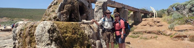
The rock formations in the gorges are huge, colourful and leave you standing in awe at the sheer size. Broken quartzite rock and sharp dolomite rock is also found.
Species of snakes, dingoes, rock wallabies, possums, echidnas, gecko, lizards, frogs are some of the
wildlife that naturally habitat in the bush. Generally wildlife will scamper off as they are intimidated by intruders but if cornered in an attempt to gain freedom they can become aggressive and attack. This is especially so with snakes.
Birdlife is in abundance and create a musical chorus as they flutter around. Parrots, budgerigars ,cockatoo, galah, mistletoe bird, honeyeaters, pigeons, zebra finches are some, with the largest being the emu and and the wedgetail eagle being king of the sky.

Also feral animals roam the bush such as horses, cattle and camels. Actual sightings of these animals is rare with footprints and manure being evidence to their presence.
The Larapinta is a wonderful hiking experience in outback Australia, one not to be missed.
Until next yarn, happy hiking.


Loved reading this, can’t wait to do this hike next year. I feel like I’m following you when it comes to hikes lol
LikeLiked by 1 person
Was a fantastic hike
LikeLike